Tuesday, June 20, 2023

Excellent June Soaring (Ridge Runs)

Around Wednesday, I got a clue that the upcoming weekend was going to be an absolutely amazing soaring day.  A cold front was scheduled to pass on Friday night, leaving cold air, and a brisk northwesterly wind.  These two factors meant that this is going to be a great soaring day.  The best part of all -- this excellent soaring day was going to happen on a Saturday, and not on some random Tuesday. 

Not only was the weather going to be great in Virginia, the winds and air aloft was predicted to be a great soaring day all the way up into Pennsylvania, too. This could be one of those rare days where the soaring is great all the way into the ridge system in Central Pennsylvania.   I had to start looking for a copilot. 

I asked two people who had previously indicated that they were interested in doing a cross-country soaring adventure with me.  Both of them were scheduled to be out of town. This caused me to expand my search.  I asked a glider pilot who lives in Miami, FL if he would be interested in joining me.  Nelson Brandt had indicated that he would drop everything and show up for a good ridge adventure, so I asked him about his availability. 

Nelson dropped everything, and found a flight to DCA on Friday. I have a spare room in the house, so he spent the night.  We woke up early, and got to the field by 0800. The glider was assembled by 10:00. The tow pilot reported that conditions aloft showed strong northwesterly winds, and even that the tow plane could soar on the ridge. What a great start! 


QQ is assembled and ready for flight by 10:00 A.M.

I had come up with an ambitious task to take advantage of the great soaring conditions.  The plan was to launch from Front Royal as early as we could get aloft; somewhere before noon would be preferable.  The task starts at the southern end of the Massanutten mountain at Laird's Knob.  From there, we would head north along the Massanutten ridge, find some thermals, and cross terrain using thermals for lift.  The goal was to get to Dickey's Mountain in Pennsylvania. At that point, we could scream along the Tuscarora mountain past McConnellsburg, PA.  We could make a transition to Shade Mountain, and go to the planned turn point on Shade Mountain near Snook airport (PS06). Then we'd turn around and come back. The whole trip was planned to be 560 kilometers out and return. We would get more credit on OLC for the trip down to Laird's Knob to start, and the trip back from Laird's knob after the finish. 
The night before included preparation by measuring 60 liters of water for the wings, and another 15 liters of water we'll use for adding tail ballast. I put the water into 20 liter jugs, so we didn't have to spend valuable time measuring water in the morning. Adding water will get the mass of the glider much closer to the maximum gross weight. This allows us to fly faster when the conditions are strong, and have a smoother flight while on the ridge.  We'll add water to the tail to make it easier to center thermals, while we're not ridge soaring. Last year I wrote a Microsoft Excel spreadsheet to calculate and display the weight and center of gravity, when programmed with pilot weights, oxygen bottles, liters of water, etc. 

Loaded with 60 liters of water in the wings, we're going to be heavy!


Adding 11 liters of water to the tail before takeoff

We launched just before noon.  We headed straight to the northernmost portion of the Massanutten mountain, to a location named "Signal Knob".  We flew along the ridge, and it seemed like it was working well.  We descended down to 2200 feet MSL, and I started to take note that the flight computer was reading a wind velocity of 6 knots at ridge top height.  I spent some time doing figure 8 motions where the lift was stronger.  Maybe the winds weren't strong enough yet? 
Also of note was the fact that the visibility was terrible. I hadn't seen any prediction of such poor visibility in the forecast.  It was hard to see more than about 5 miles down the ridge due to smoggy haze. 
We made it down to Laird's Knob near Harrisonburg, VA.  There, we turned around, and I had increased confidence that the ridge was working.  As we approached the part of the Massanutten where route 211 passes through the mountain, I made some figure-8 turns to gain height. 

By the time we got back to Woodstock, VA, a hang glider launched and was soaring in thermals.  We joined him for a short bit. 
After getting past the Massanutten, we blundered out into the hazy smog, looking for thermals. 

Satellite photo of the clouds at 14:00

14:00 By the time we got north of Winchester, we were way behind my time plan. I really wanted to launch earlier, I really wanted that ridge lift on the Massanutten to be more reliable, I really wanted the thermals to be stronger by this point.  I was starting to get anxious that the day was going to run out of soaring while we were still far from home!  

We found some marginal thermals -- one near Gore VA -- that got us closer to the West Virginia border. We headed north and finally found a thermal that gave us a really comfortable altitude of around 6000 feet MSL. The valley in front of us didn't have as wide a selection of suitable landout fields that we can usually find in the Shenandoah Valley.  This wasn't treacherous terrain, though. 

A few more thermals got us to within gliding range of Potomac Airpark, which is right across the river from Hanover, Maryland. I knew once we had a good altitude over the Potomac river, we could easily connect with the Pennsylvania ridge system. 

The winds had been really reducing our speed for all these thermals.  For each thousand feet we climbed in a thermal, the wind would push us 5 or 6 miles perpendicular to our course.  It would be a really welcome change to have a high ground speed, instead of inching along with thermals. 

By 3 PM, we had finally reached the southern end of Dickey's Mountain, and the Tuscarora mountain ridge behind it was sure to be a great ridge run at 100 to 110 knots. It did not disappoint! 

Tuscarora Ridge Soaring

We were way behind on my time plan. I was growing increasingly nervous about how we weren't as far along as I had hoped.  Back on Friday, when I was planning this flight, SkySight told me that the task was impossible considering the conditions. I was starting to wonder if the software was right!

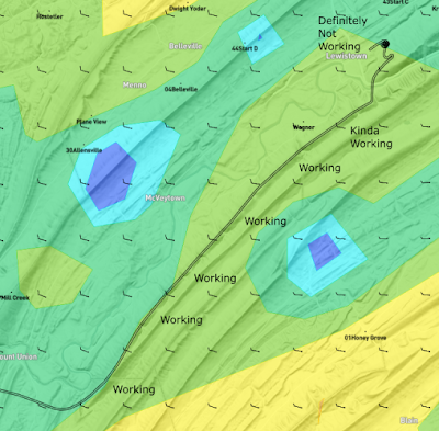
The task I had planned included one transition to an upwind mountain range.  This is a place where I would need a thermal to get high enough to go up wind and connect with Shade Mountain. Unfortunately, by the time we got to that part of the ridges, things were not looking so good.  The haze had set in, there was a really thick cloud over that area. We had no idea how the conditions were ahead on Shade Mountain. 


Sat Photo of the terrain for that transition

Sat photo of the cloud conditions when we got there

It just didn't look good.  I really didn't want to get stuck on Shade Mountain for the rest of the day.  I really didn't want to have to land out at the bottom of one of those mountains. (The fields around here are quite landable, and I would have made a safe landing for sure).  We had another 60 miles to go on the ridges to get to the turnpoint.  We had another 60 miles to get back.  At 100 knots (a very realistic speed), it would take us nearly an hour to get back to this point on the ridge again.  And who knows if the conditions are going to allow for a thermal to jump back from Shade Mountain to the Tuscarora?

I decided to turn back.  You know, we had already made an excellent trip up here, and the conditions weren't looking that great up ahead. I stand by my decision. Now we just had to get home!  This looked like it was going to become increasingly difficult. 

We headed south on the Tuscarora back to Dickey's Mountain. There, we would have to find some sort of thermal to get off of the Pennsylvania ridges. The thick layer of clouds above looked like they were going to shut off the thermals for sure.  Maybe we will be landing in Pennsylvania, after all! 


Once we got to the bottom of Dickey's Mountain, we faced the challenge of climbing up to escape the ridge system. At first, there was no real lift to work.  We needed to hang around for a bit to find something strong enough to get us high.  The overcast wasn't helping. I took over and performed some figure 8's in front of Dickey's Mountain.  We noticed a nice cloud had formed over the track we just flew under. Given the wind strength, there was no way the mountain we just flew along generated that lift, it had to come from a source upwind. 

I took the glider upwind on the other, smaller ridge, and found a great strong thermal to get us out of that mess. By the time we got out, the thermal had gotten us from 2900 feet to 5300 feet, and we had made our escape to the East. 

Our escape from Dickey's mountain required a strong thermal on the upwind slope

Once we successfully escaped from Dickey's Mountain, we still had a long way to get home. Dickey's Mountain is 55 miles away from the Front Royal Airport, and things aren't looking that great. There are a few clouds in front of us, but all of the clouds to the left of our track (to the North) look like total garbage. In the meantime, the radio chatter from Mid-Atlantic Soaring in Fairfield, PA is asking their duty officer to check for radar echoes.  The grey clouds looked ominous enough to them to make them wonder if some rain showers were developing. 
Since our task of going to Snook and back was canceled, maybe we can scrounge a little bit of glory back from this flight by landing at M-ASA and getting the Boomerang trophy... again.  We tune the flight computer, and at one point, we were 500 feet below glide slope to make it to M-ASA. After hearing the negative words from M-ASA, and seeing the yucky clouds, we make a right turn to continue heading home.  But that takes us right over the Hagerstown Class D airspace. 

When we got to the airspace around Hagerstown, MD, we got down to about 3700 feet MSL.  The Hagerstown Class D is at 3200 feet.  In order to get into that airspace, we needed to establish radio contact with the control tower. I looked up the frequency in the flight computer. Nelson called the control tower and got us clearance to transition the airspace if necessary, as we transitioned south. We found some nice thermals over  some warehouses.  We got a good look at the airport as we crossed nearly overhead.  There was a DHL cargo plane parked on the ramp, and there were a few fire-fighting airplanes that I didn't get a good enough look at. 

We found a thermal to the south of Hagerstown, MD.  It is very likely that this thermal was generated by the Maryland Correctional Institution, or the Roxbury Correctional Institution.  By looking at the circles we flew, it sure does look like the solar panels they have in the southwest part of that property are what kicked off that thermal.  

Somewhere around here, I suggest that the thermals haven't been that good lately.  Maybe we should dump the water ballast so we can work the weaker thermals.   Of course, once we dumped the water ballast, the thermals got much stronger. We dumped the water at 16:23, according to the flight logs. Four minutes later, we find a great thermal right over the Potomac River. We climbed from 2600 feet to 5640 feet in a matter of 10 minutes. I had some time to look at the scenery, and I noticed some kayakers on the Potomac river below. It had been over four hours since we took off, so I took advantage while Nelson was flying.  Nelson was doing the circling while I was... uh... dumping my own water ballast. Sometimes it's really good to have two pilots on-board for these long flights. 

Things started getting easy again.  We had escaped the overcast yucky skies to the north, and the thermal clouds are looking better.  The visibility was improving. I could just barely make out the Massanutten mountain at Signal Knob about 15 miles away. 

"Do you really want to land back at Front Royal, or do you want to run the ridge again?" 

Of course Nelson said, "Yeah! Let's run the ridge again!" 

We made Signal Knob at 2400 feet MSL, just slightly higher than the mountain.  Yep. The ridge was working, and it was working well. Unfortunately, we didn't have any water ballast, so this ride was a bit rougher than the ride along the Tuscarora a few hours earlier. 

Nelson did the ridge run southbound, and I took over once we passed the turnpoint at Laird's Knob. On the way back northbound, Nelson got out his iPhone and started recording.  We had a great video of the glider's shadow on the mountain.  As we approached Route 211, I spotted some hikers on the Yellow Cliffs Mountain Overlook


While I'm doing all the flying, Nelson made a time-lapse video of the ridge run on the northern part of the Massanutten.  You can see from this video the transition across Short Mountain. 


We safely landed after 6 hours and 48 minutes of flying. What a day! 

Piet Barber (left), Nelson Brandt (right) after almost 7 hours of flying

I'm happy that the ground crew stuck around to help us put the glider away.  We spent another 45 minutes cleaning the wings, taking the wings off, putting the fuselage back into the trailer.  I wear a special apron when I'm assembling and disassembling the glider. 

Another safe put-away after a day of soaring!

Post Flight Analysis: 

  1. When we were coming back, I don't know why we didn't use the Blue Ridge Mountains to the east to ridge run back to VA.  We probably could have spent an hour less time circling over Hagerstown, Martinsburg, Winchester.  The transition back upwind to Signal Knob might have been challenging.  On the other hand, we could have continued down on the Blue Ridge until we got to Interstate I-64. 
  2. I think the next time, I'll spend more time looking at the ridge lift near Berkeley Springs, WV. I think we could have cut down on some of the thermal time by doing some ridge lift before jumping across the Potomac River. 
  3. In retrospect, it looks like the clouds just beyond the jump to Shade Mountain meant that we could have very easily continued the journey to Snook (our intended waypoint). I didn't know this at the time.  Maybe we should have pulled up the sat photo on ForeFlight before making the decision to turn back. 
  4. I need to clean the canopy before flying next time.  I can see dust accumulated on the canopy in the GoPro videos. 
  5. I really need to find a better way to mount the GoPro in the cockpit.  A lot of the GoPro footage was ruined by Nelson's big hat. 
  6. Nelson flies with a hat in his lap to keep the sun off of his hands.  That's weird, and makes the video of him flying look weird.  Why is your hand under your hat in your lap? Sheezh. 
  7. Nelson and I get along really well in the cockpit, and have similar thoughts on the decisions we make. 
  8. I'm getting better about only turning to the left when I thermal. Doing right hand turns really helps with the GoPro footage when the camera is mounted on the right side of the canopy. 
  9. I have figured out how to find when the flight computer records the change in mass due to dumping the water ballast. Just do a search for the word "wet" (in lower case) in the IGC file. 
  10. The next time I do a plan like this, maybe I should stay on the Tuscarora ridge, instead of doing the difficult transition to Shade for no appreciable difference in miles. 
  11. We had the 11th highest score in the US for Saturday. We had the highest score east of the Mississippi River. All of the other OLC pilots in the USA had flights out of Region 9 or Region 12 (Warner Springs and Parowan)
Flight Log Links: WeGlide / OLC / SeeYou.Cloud


Sunday, June 11, 2023

Two Boomerang Flights in One Day

The night before, I saw SkySight's prediction that Saturday was going to be a great soaring day. 
SkySight had actually been predicting a great soaring day for several days in advance, but I knew that the conditions were going to be great.  Recently, there had been some great soaring days ruined by a lot of smoke from a wildfire in Canada.  I spent some time looking at the satellite photos, and air quality reports, and determined that SkySight was probably correct. 
SkySight.io thermal strength prediction for 10 June. Yellow means thermals are 5.5 knots in strength

SkySight.io prediction for thermal height.  My route is in black. Orange is 7000 feet. 

There were a few items of maintenance that I had deferred since the contest. This included some boring things like updating the firmware on the flight computer. I showed up to the airfield early enough to take care of these items without any serious time pressure. 
Evan volunteered for co-pilot duties. Since he's nice and light (158 pounds), we had a lot of room for water in the wings, and no need for water in the tail. We had loaded 40 liters of water in the wings. We had room for another 40 liters, but I didn't want to spend the extra time getting the water in the wings. 
We released over the Massanutten and immediately climbed in our first thermal. The first thermal wasn't that strong, so we moved on to an area somewhere around Interstate 66, north of Signal Knob. There, we found a strong thermal that took us closer to cloud base.
Evan and I picked clouds and flew to them. Each time I got to the top of a thermal, I'd ask Evan's opinion on which of the 3 clouds ahead we should take. There was no point where we were desperate for thermals, and every cloud was a reliable source of a thermal. It was a very easy day to do a cross-country flight, and it's a terrible shame that there were so few private gliders flying on Saturday.
Evan and I continued north towards Martinsburg, WV, then north to Hagerstown, MD. We established a good final glide, flying to the northwest of the P-40 prohibited airspace.

M-ASA operates on 123.3, so I was already on their frequency. At 4 miles out, I declared "Mid-Atlantic traffic, Quebec-Quebec, Four miles out." Immediately the peanut gallery started responding, "Oh, not you again!"
We flew over the airport, I called "Quebec-Quebec, Finish", and we connected with a few more thermals just to have fun. I flew alongside their club's 2-33, and one of their club's ASK-21s. I was flying alongside Danny Brotto in his LS-8, when I got a call from M-ASA ground. "Are you coming in to land, or what?" They asked me to land, so I dumped water ballast and pulled spoilers.  It took us an hour and 40 minutes to fly over M-ASA after release. We landed at 15:00. 

Flight Log: OLC / SeeYou WeGlide

As we landed, we saw an LS-4 lining up for take-off. It was Peter Glause flying their club's glider, Romeo Delta. Peter is the guy who got the boomerang back from us back in May. Peter was launching to Front Royal to re-acquire the trophy. There are no rules against two moves of the boomerang trophy in one day. (we checked!)  (see below)
Peter Glause is launching to re-retrieve the Boomerang trophy


We took a few pictures at M-ASA to commemorate the reception of the Boomerang Trophy.  However, the trophy was not brought to us from their clubhouse.  Mike Higgins suggested that we could get a quick aerotow to 3000 feet, and soar back to Virginia.  Or we could wait a bit longer and aero tow back to Front Royal.  
Evan Dosik and I successfully got the Boomerang Trophy... for a few minutes at least. 
Check out the Pawnee in the background.  It's launching Peter Glause. 

The conditions were still booming. After all, we pulled spoilers from 6000 feet to land in short order.  Instead of running to the clubhouse to get a picture with the Boomerang trophy, we got back in the glider and launched as quickly as MASA's tow queue allowed. We launched again at 15:29. 
After a 3000 foot tow, we connected with a thermal that took us up to about 6600 feet. 
On the way back, we chose cloud-after-cloud, and all of them worked reliably. By the time we got to Martinsburg, WV, we had 8000 feet, and the flight computer said that we were within a few hundred feet of a final glide to Front Royal with a MacCready of 2. We found another nice thermal, and tuned the MacCready to 3.0, and had 700 feet to spare after that.  I set out for a long final glide, and I even found a street along the way; which was conveniently lined up with our route home. We did the long final glide somewhere around 80 knots. 
By the time we landed, Peter had already made it to Front Royal.  He had a 15 minute head start in front of us, and had taken the eastern path around P-40.  He had crossed over to the Shenandoah Valley somewhere around Harpers Ferry.  As of Sunday evening, Peter has not uploaded the flight log to OLC. 

Flight Log: OLC / SeeYou WeGlide

There have been some questions raised about the validity of the fact that the Boomerang Trophy moved twice in one day.  Let's review the rules: https://www.brss.net/boomerang/
  1. To claim the Boomerang, you must fly a minimum of 100km (50km if L/D is less than 30:1) and land at the site where the trophy resides. Straight line or dog leg flights are permissible, and FAI rules apply
  2. The flight must originate within a 500km radius of New Castle, VA.
  3. The longest flight of the day wins. In case of a tie distance over different courses, the best speed over the course wins.
  4. Team efforts are permitted, in which case each pilots name will be engraved on the trophy.
  5. A pilot may not be involved in 2 consecutive moves of the trophy.
  6. When the trophy is claimed, the pilot is asked to notify the Blue Ridge Soaring Society of its new location.
So let's evaluate the two flights with each rule. 

Piet's flight from Front Royal to Mid-Atlantic Soaring: 

  1. Flight was 75 miles which is more than 100 km. We landed at the site where the trophy resides.  "FAI rules apply".  OK.  I'm not sure exactly what that means, but OK. ✅
  2. The flight originated from a 500 km radius of New Castle, VA.  New Castle is 231 km from Front Royal.  Check. ✅
  3. The longest flight of the day wins.  I was the only one to fly to M-ASA.  So this checks out. ✅
  4. Team efforts are permitted.  I flew this in one glider, there were not multiple gliders enroute. ✅
  5. I was not involved with the last trophy move, that was Peter Glause. ✅
  6. I updated the brss.net boomerang wiki tonight ✅
Now let's evaluate Peter's claim to the boomerang trophy to get it back to Fairfield, PA. 

Peter's flight from Mid-Atlantic Soaring to Front Royal: 

  1. Peter's flight was 75 miles which is more than 100 km. While the trophy was physically still in Fairfield, PA, it virtually resided in Front Royal after I claimed the Boomerang trophy with my landing at 15:00.  Check. ✅
  2. The flight originated from a 500 km radius of New Castle, VA.  New Castle is 347 km from M-ASA.  Check. ✅
  3. The longest flight of the day wins.  I was the only one to fly to M-ASA.  So this checks out. ✅
  4. Team efforts are permitted.  Peter flew this route in front of me, and it was not a team effort.  While I made the trip too, I didn't make any claims to the trophy for my second flight. ✅
  5. Peter Glause was not involved with the last trophy move, that was me, 2 hours prior. ✅
  6. I updated the brss.net boomerang wiki tonight ✅ 

Sunday, June 4, 2023

Why Does Piet Fly So Slow, Mifflin Day 2

Introduction: 

Day 2 was a classic "Mifflin Day", with suitably strong winds from the north. The shape of the mountains in this area favor a task that goes to the north and east of the Mifflin airport.  The task for day 2 was: 

Turnpoints
#IDNameRadius
Start44Start D
-26SchuylkillCo20.0
-1Honey Grove10.0
-35Shade Mtn10.0
-9Mill Creek15.0
Finish51FINISH2.0

Here's a map overview of all the gliders that flew in the 20m multi-seat class: 


The turn areas are indicated as large red circles. QQ is in dark red, and the winner for the day, Hotel-Hotel is in cyan.  I ranked a terrible 12th for the day. The only competitors who did worse than me were Hotel-Seven and Four-Delta.  Hotel-Seven landed at Selingsgrove (just next to the Susquehanna river) and Four-Delta motored home. When I saw my place on the scoresheet, I couldn't believe how poorly I ranked for what I thought was a good flying day.  Let's figure out where I went wrong. 

Piet's Flight Narrative:

I started as soon as we were allowed.  I started at the most southerly part of the start line as I could, at the highest altitude I could make.  I headed straight to Shade Mountain.  KS flew along my left wing, faster, and got to Shade Mountain first.  He had a much higher speed along the ridge than I did, but we ended up getting to the turnpoint at Shade Mountain at about the same time.  We connected with a strong thermal, and made the jump over the Susquehanna River.  KS was much further ahead than I was. 


You can see the gliders following KS and me as we head toward the Susquehanna River.  This is before we climbed in a thermal.  This part of the mountain isn't as good for ridge soaring, so our ground speed had to slow down significantly at this part of Shade Mountain. 

I turned around about five miles too early.  Karl was much further ahead of me on the Northumberland mountain, and turned around at about the same time. I think I lost about 8 miles total distance by turning around early.  I'm not sure why I turned around here.  In retrospect, I should have gone further.  Looking at all of the other traces, everybody turned around about the same place Karl (KS) did. 

When we tried to jump back across the river, a traffic jam formed up.  Many of the gliders that were behind me started to pile up near the river.  We all struggled to find enough thermal.  I headed out early, and found a strong thermal right over the river. (Yeah, this doesn't make sense to me, either). 

There I am, escaping over the river, while others are still struggling
There I am, escaping over the river, while everybody else struggled to gain height

Once I climbed on that thermal over the river, we had plenty of altitude to make it back to Shade Mountain.  I asked my copilot to fly straight and level while I tried to take off my jacket.  I could not take off my jacket. In order to keep from overheating, I took a mouthful of water and spat it onto my chest. The jacket struggle is real! 

I flew down Shade Mountain until the direction of the wind didn't look very favorable with the direction of the ridges.  Right around Lewistown, PA, Shade Mountain takes a turn to the left, no longer perpendicular with the northerly winds.  My flight computer was showing winds of 035 at 8 knots.  In retrospect, the other flight computers of the competitors showed more like a 360 at 18 knots. Maybe I need to tune the HAWK variometer's wind parameters.  At any rate, my early turn-around cost me between 10 and 12 miles, depending on where each competitor turned around. 
QQ (in red) turned around just after getting into the circle.  Everybody else went further.
QQ can be seen at the top right of this map

The third turn area was Shade Mountain, 10 mile radius. You might see a pattern here. Of course, I turn early.  The pack following behind me turned much later. I cheated myself out of another 10 miles. The distance isn't that important, but the fact that I'm covering these distances at 80-100 knots means the opportunity to raise my average velocity is lost when I turn early. 

The final turn area was along Jacks Mountain.  As you can guess, I turned earlier than everybody else.  I turned almost 7 miles earlier than everybody else did.  This cheated me out of 14 miles of flying at ridge speeds, and most certainly reduced my speed for the day. 

Winner's Analysis: 

Let's compare and contrast what Noah Reiter did (HH) and what I did: 

Noah was last to launch.  His copilot was one of the tow pilots for the day.  I think this worked to his advantage. I started at 13:31, and he didn't start until 13:49. Noah was still in his first thermal climb while I was starting the task.  Why did I start so early?  I don't know.  I'll have to figure out why I have a tendency to start as soon as possible.  It could be because I don't really understand the strategy of the start games that the experienced pilots play. 

When Noah was starting the task, I was circling with Karl to make the jump across the Susquehanna river. 

Noah crossed the start line in the center of the start line.  I started on the southern end of it.  I don't think that made much of a difference.  Noah started lower across the start line than I did. Noah got to Shade Mountain at about the same height and position that I did. 


So far: Noah's track isn't that much better than mine. 

Before jumping across the Susquehanna river, I climbed to 3600 feet MSL. That thermal climb took about 7 minutes. Noah did a climb on Shade mountain about 2 miles to the west of where I did, and spent 5 minutes in thermal.  He left that thermal at about the same height I did. We both got across the river in the same amount of time, and showed up at about the same place. 

First Turn Area Observation

Noah made the right decision to go as far as he could into the first turn area. It's unclear why I turned early. When I turned it was 67 miles into the task.  When Noah turned, it was 72.7 miles. It took him 6 minutes and 23 seconds to go that extra distance.  During that difference in our ground tracks, he had an average of 107.15 mph. 

Noah "HH" (cyan) turned later than I did (red), and made great speed while doing so

Second Crossing of the Susquehanna

It took me 17 minutes to find a suitable enough thermal to get across the river. I made 3 thermal attempts.  Noah did the crossing in 14 minutes, and also made 3 thermal attempts. 

Second Turn Area

As mentioned before, I turned before everybody on that ridge.  This was no exception with Noah's flying.  He turned 4.6 miles later than I did.  The extra time on his trip was almost 6 minutes.  The average velocity while he did that extra 9.2 miles was 92.7 mph. 

Noah "HH" turned later into the turn area than I did. 

Third Turn Area

This is beginning to be a theme.  I turn just a few minutes after getting into the third turn area.  This is along the same section of Shade Mountain that I had been on earlier in the day.  I don't know why I turned when I did, or why I decided to turn at that point. I made my turn at 15:30:23, and my distance task so far was 162.7 miles in total. When Noah did his turn, it was another 13.1 miles of distance, covered in 9 minutes and 52 seconds. 

Shade-Jacks Transition

Noah and I both circled in thermals at about the same point on Shade Mountain.  He did a much better job of circling, left earlier, arrived at the top of Jacks Mountain. He started his upwind journey to Jacks Mountain at 3070 feet, where I started at 3260'.  He arrived at Jacks mountain at 2034', where I arrived at 2385'. It took Noah only 7 minutes to do the transition. It took me 9 minutes. The numbers aren't that terribly different, but he certainly did a better transition here than I did. 


Noah did a slightly better transition from Shade
Mountain to Jacks Mountain than I did

Mill Creek Turn Area (Fourth Turn Area)

In the final turn area, Noah covered another 8.3 miles, and it took him almost 6 extra minutes of time to do this. In the meantime, I came in for a landing well under the minimum time. On my return leg, there wasn't much point in pushing the return trip.  I was going to suffer a time penalty and it was going to hurt my score either way.  Noah had managed to fly the course without a minimum time penalty, and he was the only one in our class to do so. 

Piet's Lessons Learned from Day 2

  • When doing a ridge task, do everything you can to go as far into each turn area as you can safely accomplish.  Those extra miles make all the difference, and you'll be less likely to come in under the minimum time. 
  • If there are four turn areas, and you turn earlier than everybody else in those four turn areas, don't be surprised when you come in dead last. 
  • At least I didn't land out.  My low altitude scratching skills aren't that bad.  It took me about the same amount of time to transition across the Susquehanna river as everybody else. 
  • I should have a better understanding of how much altitude I need to get across the Shade-Jacks transition, without having to spend extra time tanking up on altitude. 
  • Leaving first out of the starting gate on a ridge day is stupid.  Especially for somebody of my skill level. Let one of the more seasoned veterans go first. On the ridge, they're not going to pull that much further away from me. 
  • Figure out why the HAWK variometer is showing wildly different wind directions while doing ridge flying. There were times in the flight when the flight computer showed 180 degrees out of phase with what the winds were really showing. (I have disabled the compass on my flight computer, and will do another software update before flying on the ridge again)
  • I judged the correct mountains for this task.  Other guys went to the Tuscarora.  They didn't place that well.  I took the right course, just didn't go far enough into each turn area. 
  • I could probably fly a few miles per hour faster along the ridge than Noah did.  I had water in the wings, and Noah didn't. I think I can get lower on the ridge and make better speed. 


Saturday, June 3, 2023

Why Does Piet Fly So Slow? Mifflin Day 1

I never really had time to analyze every flight at the contest.  Now that I'm sitting at the comfort of my home, I can download all of the log files and pull them up in flight analysis software. 

I know I have a lot of work to do to get to be a better competition pilot.  I suspect seeing what the fast guys are doing might be one avenue for my improvement. 

The first day was a setback for my position on the score sheet.  At the end of the flying day, I placed 11th, and had no idea how people went so much faster than me.  After watching the "worm races" in SeeYou, it's incredibly obvious why I was so slow. There were many reasons. 

Recap: 

Day 1 had kind of an overcast over the area.  The clouds were really hard to read.  The winds were about 265 at 14.   There were good thermals, and I climbed to 6400 feet before the start.  I descended to just under 6000 feet to cross the start gate.   

It was at that point that I had lost.   So soon into the adventure and I had already lost the day. 


I'm the glider in orange with the ∑ shaped ground track on the right of the screenshot above. The winner for the day, "Hotel" is the cyan colored track heading almost due south.  While I decided to tank up on more lift after crossing the starting line, he's headed for ridge lift.  There are two other gliders cruising toward Shade Mountain at speed.  I've already lost! 

Before I had even made it into the first turn area (orange line at the 1 o'clock position on the circle), these three guys had made it deep into the turn area, and were on their way back. They haven't made a single turn.


How did I miss this?

 I should have gotten a better understanding of which ridges work with which winds.  When there is a westerly wind, flying to the south is more advantageous.  When there's a northerly wind, the ridges to the north and east are most lined up with the winds. Just because the ridges aren't really lined up for ridge lift at the start area doesn't mean that the winds won't work with the ridges elsewhere. 

Take-Aways:

  • Look at the task on the map. Note the winds, see if there are any ridge "highways" we can use along the way. 
  • Forget about getting into the wave.  The task is designed with the assumption there is never any wave.  The wave lift around here isn't good for long stretches like it is near Front Royal. 
  • If you're all alone, there's probably a good reason.  Everybody is somewhere else, going faster than you. 
  • Plan a course deep into the first turn area, if possible. 
  • I should have an idea how fast I should be going, and refer to the average speed so far. If I'm below it, stop whifferdilling with every small scrap of lift. 

It Could Have Been Worse:

  • It looks like 98 and EL their motors to get home. They still outscored me, and they used their motors at the very end of their day.  
  • At least I didn't land out. 


Monday, May 29, 2023

2023 20 meter Multi-Seat Contest (Mifflin)

This May, I participated in the 20 meter multi-seat national soaring competition held in Mifflin County, Pennsylvania.  I drove the mighty QQ to Mifflin on the evening of Mothers' Day.  I drove to Pennsylvania with Uwe Jettmar.  Erik van Weezendonk arrived on the following day.  The contest was scheduled to take ten days in total.  

Practice day: 

Monday was a practice day. that meant that all of the participants had the option to fly their glider at the airport where the contest was about to take place.  The contest director determines task, and all participants arrive at the runway on a first-come-first-served policy. The conditions were weak, but I decided to attempt the task anyway. 

Practice Day Task Layout
Erik was not due to arrive at Mifflin until about 1 pm.  Uwe and I assembled QQ with the help of another contestant.  We left the trailer hooked up to the pickup truck, as we set out on the task.   The task was a large area to the northwest (Nisbet), and another large circle to the west of Mifflin (Kettle Dam). The soaring conditions were weak. We managed to get to the first turnpoint.  After that, there wasn't much lift.  We limped along the Nittany ridge, hoping for some better opportunities to get higher. As we approached State College, I elected to do an off-airport landing at the largest field I could see.   The land-out was uneventful.  We landed in a cornfield that appeared to be fallow. Erik arrived a short time later, and the retrieve was uneventful. Because of the loose soil we landed in, we elected to leave the trailer on a gravel access road, and tow the glider out of the corn field with a long rope attached to my pickup truck. 
I tend to land out at every contest.  I suppose it's good to get this out of the way early in the contest. Much like the importance of pre-season games in the NFL, my standings aren't harmed by landing out on the practice day. 

Flight Track on SeeYou.cloudWeGlide


QQ getting towed out by rope

Day 1: 

Today was Erik's turn to fly. The task was originally set to be a 3 turnpoint assigned area task, but once the fleet was airborne, the task advisors suggested we move to the stand-by task.  This task had a 15 mile turn area to the south, Orbisonia, and a 15 mile turn area to the northeast, Shade Mountain. 

The beginning of the task had strong lift in thermals.  There were no reliable marker clouds to work with, and there was a pall of overcast over most of the area.  Once we got started, I climbed to what felt like wave lift above 6500 feet.  Unfortunately, the start line had a maximum altitude of 6000 feet.  I flew at high speed to the start line, got just under the maximum altitude for the start line, and couldn't get back into the wave lift.  For the rest of the day, I spent it hoping to get high enough into the wave. 

We tiptoed too much.  I ranked 13th out of 15 contestants for the day. The winds were lined up to work the ridge to the southern end of the task area.  I never made use of ridge lift.  That definitely could have helped my speed on task. We never got low, and I never got desperate, but the pain of how poorly we showed up on the scoresheet reminds me that everybody at this contest knows how to fly faster than me. 

Flight Track on SeeYou.cloudWeGlide, SSA Scoresheet

Day 2: Ridge Mission #1   

This is the day we were all waiting for, and the reason we drive to Mifflin.  Central Pennsylvania has an intricate network of mountains that are perfect for glider racing.  Depending on the wind direction, you can zoom along at treetop height, connect with other mountains to cover hundreds of miles. 

Day 2 was one such day.  The winds were predicted to be coming from the north for the whole day.  The winds were not so strong that thermals would be disrupted. The weather-guessers predicted all kinds of adventures with good ridge, good thermal lift for the whole area.   The task advisors came up with a suitable task that included a trip across the Susquehanna River into Northumberland, PA. 

I started across the start line near Lewistown, PA.  I set out to the first turnpoint from the maximum altitude, cruising at 110 knots until I got down to ridgetop height along Shade Mountain. Karl Striedieck and Sarah Arnold passed me on the way to the mountain.  I kept them in sight as we both zoomed along Shade Mountain.  The northern part of Shade mountain is more rounded than the area where we started.  We had to slow down to maintain position on the ridge.  We found a great thermal, and got enough altitude to make it across the Susquehanna river and to the next set of mountains near Northumberland, PA. 

Karl was gone, but a speck of dust in the distance.  I could barely see that he had enough to get to the top of the mountain across the river.  Uwe quietly watched me cruise across the river and intercept the next mountain ridge with just the right amount of altitude. I went into the turnpoint as far as I wanted to venture, and turned back to jump across the Susquehanna River again.  I passed a dozen gliders travelling on the ridge. Since both gliders were going more than 100 miles per hour, the closing speed was about 200 miles per hour.  Jim Frantz of New Castle, VA was flying his Ventus 3.  It was equipped with a strobe light on the nose which made him quite conspicuous! I need one of those! 

When I got to the Susquehanna river, there wasn't a good enough thermal to make it out of there.  I hung out with one of the Standard class guys for a while, as I saw other 20 meter gliders show up and try to dig out. 

Eventually, I found a nice enough thermal to get away from the ridge.  I headed directly to Penn Valley airport just-in-case.  Strangely, I found a thermal right over the river.  It was enough to get us the altitude we needed to get back to Shade Mountain. 

I followed Shade Mountain until just after Lewistown, PA.  At that point, the ridge turned unfavorably, so that the winds would no longer support ridge soaring along that part of the mountain. I headed back upwind to get back to Shade Mountain (the third turnpoint).  Heading south again, my next challenge was to find a thermal to make it upwind to Jacks Mountain, near Mifflin. It took me longer than I wanted, but I made it with plenty of altitude to spare. Once on Jacks Mountain, I took the ridge as far as I could muster.  Jacks Mountain will work with a northerly wind, but not much past a point called "Mill Creek"  It was there that I turned around and headed back home.  

I was proud of my accomplishment until I saw the score sheet.  I placed 11th. Man, I suck at this racing thing. Maybe I will enjoy this contest more if I just stop looking at the score sheet. 

Flight Track on SeeYouWeGlideSSA Scoresheet

Day 3: Slow Start, Backside Jacks

The task originally called for a racing task.  The thermal conditions weren't as good as predicted, so the task advisors suggested we go with an Assigned Area Task instead.  Erik was co-pilot. 
I spent 1.5 hours in the start area, waiting for the conditions to be strong enough to get on-course. 
We headed toward Shade Mountain, transitioned to the Tuscarora, came back, flew the backside of Jacks Mountain until the ridge turned to the south to a heading where the winds would no longer hold us up.  I returned, never having any real problems, and never getting really low.  Somehow we managed to place 5th for the day.
I got some great in-flight footage with Papa Lima while flying on the backside of Jacks Mountain.
 
Flight Track on SeeYouWeGlideSSA Scoresheet

Day 4: Backside Jacks Mountain

The winds were pretty much right out of the south.  This was a rare day when we both have enough convection for thermals, and we have a southerly wind strong enough to fly in Jacks Mountain. 
After starting, I follow the pack northward toward the northern end of Jacks Mountain.  The task requires us to get upwind to Shade Mountain, but the conditions didn't look like I could make it. Once we got to the end of the mountain, we went north a bit more, but the thermals weren't quite there yet. I headed back south, and flew in formation with Hotel-Hotel out of Haris Hill. I had Erik take some GoPro footage of HH in flight.  That video turned out great! 

Somehow we managed to take 5th place for the day. I've moved up to 8th place overall. 

Flight Track on SeeYou, WeGlide, SSA Scoresheet

Day 5: Long Ridge Flight

On Day 6 the winds were much more favorable for most of the ridges in the area.  The task called for a much longer trip, covering far more miles. We started the day early with an earlier-than-usual launch time, but it didn't make much difference.  I spent an hour in the start area, trying to get enough altitude to get into the start line.  
Day 5 had us cover the most miles
Day 5 covered the most ground

I finally got past the start line and headed due-south to Shade Mountain.  I cruised somewhere between 100 and 105 knots at tree-top levels. The glider was fully loaded with water for maximum speed. We got to the southern end of Shade Mountain, where several gliders circled around, trying to get enough altitude to get to the Tuscarora mountain.  Some of the heavier gliders turned back, noting that they don't soar very well with the weaker ridge conditions. I headed south for some more easy speed points. 
I followed Papa-Golf and Hotel-Seven along the ridges until the very end of this mountain chain, at a place called "Dickie's Hill."  This part of the mountain chain is very close to the Pennsylvania - Maryland border. 
Heading back north, I got stuck on the transition from Tuscarora to Shade Mountain.  I had been slowing down so I could get high enough to make the jump without circling.  This was a dumb strategy, as I ended up at the same altitude anyway, but doing it much slower. 
Karl Striedieck passed me at this point; maybe 500 feet below me.  Apparently, he knows the exact altitude it takes to do the Tuscarora-Shade jump.  I followed him, along with Papa-Golf and Hotel-Seven. 
Karl passed Papa-Golf, but I couldn't quite bring myself to fly close enough to Papa Golf to get past him. By the time we got to Lewistown, PA, we had to make a reasonably-sized jump upwind across the Juniata river. 
At this point, we had to make a long upwind trek to White Pine. I found what I thought was a good cloud street, and stopped to climb in a thermal.  Papa-Golf kept going along Shade Mountain. Hotel-Seven circled with me up to about 6000 feet. I thought Hotel-Seven and I were going to hang-out, but he went further down the mountain to hang out with Papa-Golf. I started to find thermals, and tried to street upwind. We were never low, and never in jeopardy of landing out, but it took forever to fight the headwind. I touched the turnpoint and headed downwind. 
The flight computer is telling me I'm slow.  I know I'm slow. We are on track to finish the task on time. I'm annoyed about how long it took to go upwind toward Nisbet, so I'm looking for some fast-tracks to absorb out some of that slow flying I did. I see a magnificent cloud street toward Mid-State airport. The flight computer tells me that I will be well over-time when I arrive at the finish line. Oh well. 
I fly alongside Karl Striedieck along Jacks Mountain.  In fact, I even passed him at one point.  Right after I passed him, I found one of the weaker parts of the ridge, so I slowed down, and went upwind to "the step" along Jacks Mountain.
I was too low to see that Erik had applied a bag of lime to a road that crossed over the peak of Jacks Mountain. He painted "QQ" in big bold letters. Unfortunately, I never saw it, as I was too low, and didn't have the right angle to see it. The rest of the pilots saw it, though!


I ranked 15th for the day.  Holy crap I really suck at this. I think about that scene in Caddyshack with Chevy Chase and Rodney Dangerfield, "You're uh... 'not good'."   I have no idea how everybody else was 7 miles per hour faster than me. I'll have more fun if I stop looking at the scoring sheet. I'll have to do an analysis of the flight logs of everybody else to see why I suck so bad. 

Flight Track on SeeYouWeGlideSSA Scoresheet

Day 6: Racing Task

This was a day that featured no ridge soaring. The thermals were strong, and there were streets everywhere.  Day 6's task didn't have large turn areas.  Instead, we had to get within 0.3 miles of each turnpoint. This meant that we all had a good understanding of how well we are doing, relative to everybody else. Days 1 through 5 were Assigned Area tasks.  For those tasks, the competitors go figure out the course they think will get them the most points.  Nobody knows how well they did for the day until the score sheet is posted. 
Day 6's task looked like a capital W.  I followed the clouds as best as I could. I thermalled when it was good, I never got low, I passed up on marginal thermals. I flew over the Raystown Dam. I saw a glider in the distance, circling, and I headed toward that spot he was thermalling. I kept up with all of the gliders that had caught up with me at the first turnpoint.  
Starting early really hurt me, and we ranked 11th for the day.  Somehow, we've moved up in the rankings, and we in 8th place overall. It's not that we're doing well, it's just that some of the other pilots who did well on other days landed out or withdrew. 

Flight Track on SeeYouWeGlideSSA Scoresheet

Day 7: Another Racing Task!

I really like the racing tasks.  I don't have to think too much.  I just show up, fly to the waypoints, try to find a way to the next waypoint.  If I could choose, we would have nothing but racing tasks. 
 I was the first to start the task, and I headed directly Across Seven Mountains on the way to White Pine airport.  To me, the day felt like it was going to abruptly end.  Spending time with start-line games felt foolish. Especially since I'm so slow, as evidenced by the scoresheet. 
In retrospect, it might have been dumb to start as early as I did.  Everybody who started later got to analyze exactly where I was circling. They could see me really clearly because my glider has a transponder and ADS-B. I spent more time at the slow part of the task. 
By the time I just passed the first turnpoint, everybody in the 20 meter class caught up with me, or passed me. Well, we all established by the scoresheet that I kinda suck at this racing thing. It sure was a nice day to fly, though.
The next turnpoint was MidState airport, which is also on the Appalachian plateau.  There are almost no landable fields directly between these two turnpoints. I spent time with Hotel-Hotel for a brief while.  At some point, he went right, and I went left. 
Hotel and Hotel-Seven met up with me and we traded spaces for a while. They would find a good thermal to work, while I pressed on.  When I found a thermal I liked, they would join me. 
We got slow and worked on weaker thermals as we approached the southwestern-most point. Unfortunately, I didn't keep with the pack, I went right, when the pack went left. I really suffered for this.  Everybody left me behind. We limped north to Penns Cave. The sky looked really bleak. I made the turnpoint. We haven't seen a good thermal in a long time. There is a huge deck of overcast 
and made it home without ever really being desperate for altitude. I don't know how I managed to take 6th place. 

Flight Track on SeeYouWeGlideSSA Scoresheet

Day 8: A Two-Thermal Day

I can't believe we've had this much great weather.  To have a contest with 8 flyable days is utterly inconceivable to me. 

We were on grid position 24.  There was only one glider launching after us.  By the time we were off tow, all the other gliders had climbed several thousand feet, nearly to cloudbase.

After getting off tow, I couldn't find any lift.  We scrounged around for a morsel of lift, but found nothing. I landed at Mifflin, came to a stop.  Within 30 seconds we were back in the air behind the same tow plane as before. "Don't tow me to where you dropped me off last time."   He dropped us off where we released last time. 
There was no improvement in the soaring at that location. In the time it took for us to land, take off again, release from aero tow, the fleet had started the task. 
I was left scrounging around looking for some lift in the start area.  I found a thermal right over the airport.  I climbed to 6400 feet MSL, and headed through the start line, on course. 
I'm pretty sure Hotel-Hotel and I were the last ones on course.  I looked at the flight computer to see if there was any of the fleet in front of us. They were all specks in the distance. We're so far behind, we're so screwed. 
I turned left near University Airpark airport at State College, and follow the Tussey Ridge.   Tussey has thermals popping off of it.  The flight computer insists that the winds favor the ridge.   Eventually, we get down to ridgetop level and find that Tussey is indeed working.  Not working really well, but we are maintaining 80 knots along the mountains, well south of Spruce Creek. 
Papa-Lima is on the ridge with us.  We notice some of the pack of gliders flying overhead. Everybody is high except for Papa-Lima and us. 
At the southern end of the turnpoint, we expect Papa-Lima, who is slightly ahead of us on the ridge, to turn around.  They did not.  Instead, they turned left. They went downwind off the ridge to some questionable terrain downwind.  Questionable unlandable terrain with a lake and a smaller ridge. "Nope. Not following them!" 
We turned back north, slowed down to get some altitude, and waited for a strong thermal to connect, so we could climb high and move on to the next turnpoint. 
We found a great 8 knot thermal and climbed to over 6500 feet.   We set out downwind. There were several mountains in sight ahead of us that would have worked great.  I elected to use Shade Mountain.  We could go up Shade Mountain and use ridge lift along the way.  Hey, ridge lift has been working so far, right? 

The image above is a view of SkySight's predicted winds at 2000' MSL (approximately the top of the mountain).  The lines indicate a wind from the west.  Each barb is either 5 knots or 10 knots of wind. Our flight track along Shade Mountain is shown with the black line.  Our path was from the bottom left of that diagram to the top right of the diagram.  I've marked my opinion about how well the ridge was working for us along the way.  "Working", "Kinda working", and then finally, "Definitely Not Working"
After making the transition across the Juniata river, the northern portion of Shade Mountain was "Definitely Not Working" and we were looking for a place to land.  There were no thermals to work with, since an overcast sky blocked out all the sun. 

We came in 12th place that day.  Papa-Lima, the one that took that bad left turn at Altoona, ranked 13th for the day.  They never got off of Raystown ridge, and did a landing at an airport much further back on the course than we did. 
I had the GoPro running while we were deciding which field to land in.  This could be a valuable resource if you've never seen an off-field landing in a glider before. 


Flight Track on SeeYouWeGlideSSA Scoresheet

Day 9: Wrapping it up

Unbelievable! We had 10 days available for soaring, and we flew on 9 of them. 

The only way we're going to place in this contest is if we are the only ones to make it around, while everybody else lands out.  This isn't going to happen.  Instead, I decided to have a lazy fun day, and my average speed showed it.  We came in dead last (11th place) for the 20 meter multi-seat class. This flight wasn't particularly remarkable, so I won't go into much detail. 

Strangely enough, we had come in sixth place overall.  All of the other competitors who ranked lower than us had made more mistakes than we did. 

Flight Track on SeeYouWeGlideSSA Scoresheet