I also mounted my GoPro, but didn't look at the settings closely enough when I mounted it. I have 5 pictures stored from my GoPro; each time a nice picture of me fiddling with my cell phone trying to get the video camera to start recording. I guess I need to work on that technique a bit more.

Tuesday, December 29, 2015
Video along the Ridge
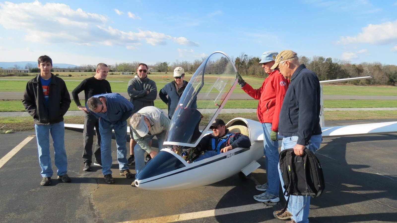
A few days before Christmas, I got to take some friends along the ridge for some flights in my Duo. One of the passengers, Craig Sutherland -- documented the flight with his hand-held GoPro.
I also mounted my GoPro, but didn't look at the settings closely enough when I mounted it. I have 5 pictures stored from my GoPro; each time a nice picture of me fiddling with my cell phone trying to get the video camera to start recording. I guess I need to work on that technique a bit more.
I also mounted my GoPro, but didn't look at the settings closely enough when I mounted it. I have 5 pictures stored from my GoPro; each time a nice picture of me fiddling with my cell phone trying to get the video camera to start recording. I guess I need to work on that technique a bit more.
Friday, October 23, 2015
Saturday Soaring with Keith
With a brisk northwesterly wind in the forecast for the weekend, Saturday and Sunday were both shaping up to be a great weekend to be a glider pilot. I wrote one of my former students, Keith, if he wanted to go ridge running with me in the Duo Discus. He quickly accepted the offer.
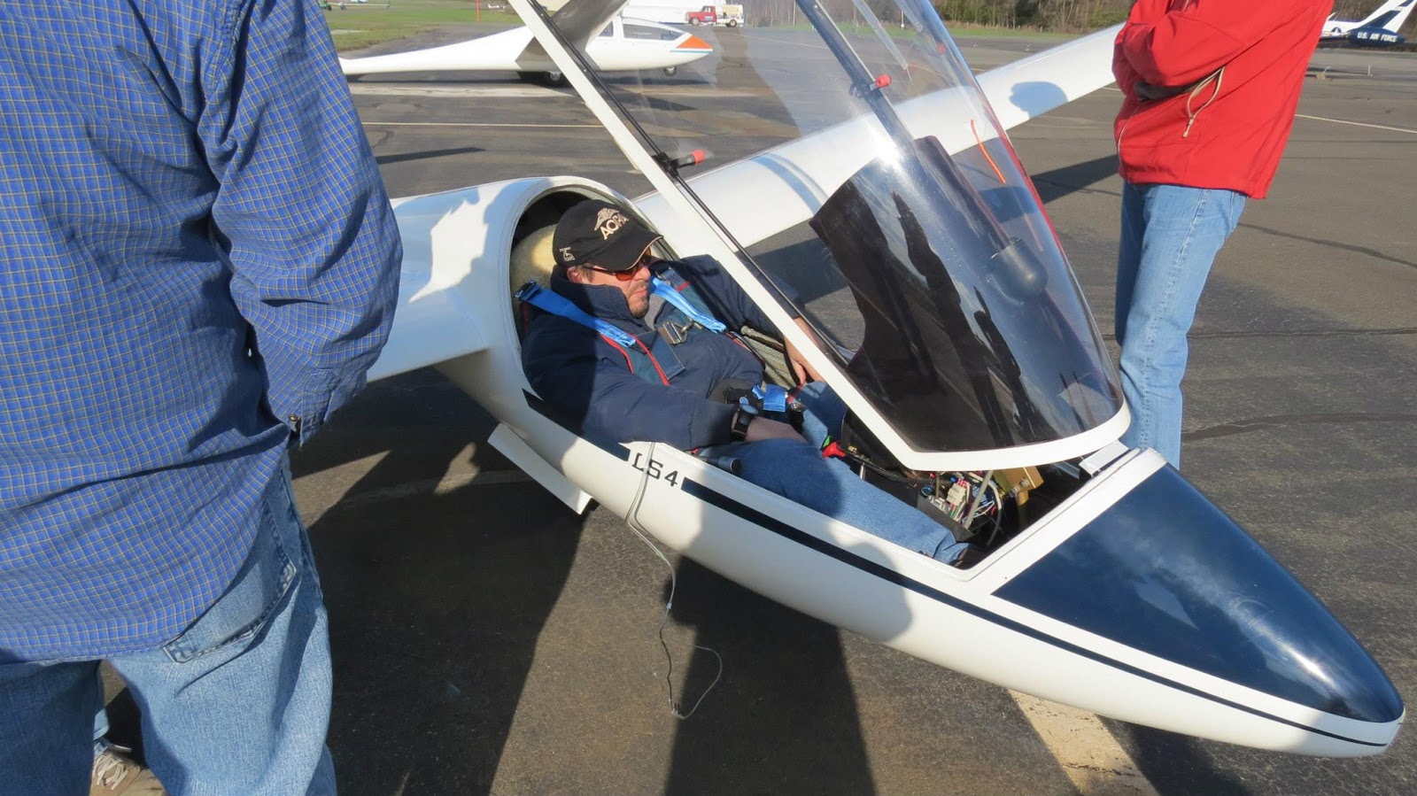
We arrived reasonably early, assembled the glider, and spent some time trying to figure out why the SN-10B still isn't talking to the NANO III flight computer. Several things were pried open, checked out, and still no firm conclusions as to why the NMEA input isn't making it into the SN-10. That's still on the things I need to get solved on my new glider. The flight computer has limited functionality while there's no GPS feed, and I can use maps and the tiny visual display on the Nano for navigation.
Once airborne, I got the glider down the ridge. We were the so-called "Ridge Dummies" -- the first glider up for the day, to test out the wind direction and strength on the ridge. Once I confirmed that the ridge was working, I called back to home base, reporting that the ridge was working. We maintained 3000 feet at about 80 knots along the top of the Massanutten mountain range. For a short while, we met up with 3 or 4 hang gliders, launching out of the Woodstock Hang Glider launch area.
The day was also shaping up to be good for thermal activity, too. I followed a street westbound, and crossed over the Virginia / West Virginia border. We passed north of the Bryce ski resort, and I even got far enough west that I had the Grant County airport in sight. As we continued west, the thermals got more sparse, and had less strength. We descended from the comfortable 6500 feet down to about 4000 feet as we searched for lift.
Whenever I'm flying with somebody, I often ask them, "Still having fun?" "How are you doing up there?". Keith responded through the flight with enthusiastic rapid responses, "Doing great!" "Really enjoying myself!" As we approached our westernmost point, with ever decreasing altitude, I asked again:
"Still having fun?"
There were a few moments of nervous silence coming from the front seat. "I'd really like to see the needles pointing upward" Keith was growing ever more uncomfortable with our situation. His comment indicated that he would rather we be in lift. The safety of flight was never in jeopardy: there were some magnificent, large fields 2 miles to the northwest, next to the town of Lost City, WV. If somehow the thermals abruptly stopped producing lift, that field next to the town center would have been longer and wider than the airport we took off from. We also still had plenty of altitude to make a downwind dash across the Shenandoah valley back to Short Mountain, next to Mount Jackson, VA.
I connected with the thermal that I was sure was located under a white puffy cloud, and climbed back up to a comfortable altitude. Soon, we were headed west again, back to Short Mountain.
On the way toward Short Mountain, we hit a very minor small bit of turbulence. I heard a very loud noise. "CRACK!" It sounded like a lead weight had fallen off of a table, and slammed onto the bottom of the back of the fuselage. Since I was in the back seat, it was especially loud. I had a few moments of cautious discomfort, with images in my mind of the empennage suddenly disintegrating behind me; pieces of expensive fiberglass and carbon fiber departing the aircraft. The controls still worked. Keith and I talked about it briefly, and got on with the flight, after determining that the aircraft was still apparently intact.
We did ridge soaring down to the southern end of the Massanutten mountain system, in close proximity to the Massanutten ski resort. I stopped at a waypoint called "Laird's Knob", where Keith got out his camera to get some great pictures of the fresh fall foliage on the nearby mountain.
After hanging out over Laird's Knob, I followed a cloud street eastbound, where the clouds looked best. We connected with an incredibly strong thermal, and climbed at 900 feet per minute to as close to cloud base as I could legally get. We were so amazed about the 9.9 knots shown on the flight computer for average lift, that I had Keith take several pictures. Unfortunately, the peak strength of the thermal was a few moments before this picture was taken.
The thermal was so strong, I asked Keith, "Hey, we could go down to Waynesboro!" The conditions were really that strong. Keith instead opted to go north, back to home base. We had been up for 2 hours, and I guess he was getting cold.
Along the way, we got some nice photos of Skyline Drive, along the Blue Ridge mountains. It's near peak foliage, and Skyline Drive was packed with "LeafPeepers" -- tourists who wanted to see the National park in all its glory.
After a glorious flight along the Blue Ridge, where we just bopped along at altitude, without stopping to work lift, we did a final glide back to the airport. By the time we landed, things were getting pretty overcast and grey. The weather was much colder.
Keith recorded my approach and landing. We had a crosswind coming from the right on final, and I think I did a pretty good job practicing a side slip to attain runway centerline alignment. I'm still trying to figure out how to land this new glider of mine. :)
During the post-flight inspection, I determined the cause of the sudden bang in-flight. I don't normally seal the wing root with the fuselage on this glider. The previous owner did a great job of sealing the joints with some foam. This way, the air won't leak in between the fuselage and wing root, causing whistling noises in-flight. One of the pieces of foam has come loose, and it causes the glider to squeak in some particular attitudes in flight. So this flight, I taped up the wing root to prevent the noise from happening. The tape I used isn't much different than white electrical tape that you would find in a hardware store.
In flight, the conditions were cold enough, and the tape was stretched tight enough that the gap seal tape ruptured catastrophically. The whole right wing had a rip up the seam in between the wing root and the wing. I guess the next time I buy gap seal tape, I don't buy the cheap stuff. Also, when I tape up the wings, I'll give a little room for the tape to stretch when the wings bounce around in turbulence.
While only flying for 3 hours, I managed to rack up 247 OLC points. I'm pretty sure we could have made it to Waynesboro and back, without any stress about returning to Front Royal.
We arrived reasonably early, assembled the glider, and spent some time trying to figure out why the SN-10B still isn't talking to the NANO III flight computer. Several things were pried open, checked out, and still no firm conclusions as to why the NMEA input isn't making it into the SN-10. That's still on the things I need to get solved on my new glider. The flight computer has limited functionality while there's no GPS feed, and I can use maps and the tiny visual display on the Nano for navigation.
Once airborne, I got the glider down the ridge. We were the so-called "Ridge Dummies" -- the first glider up for the day, to test out the wind direction and strength on the ridge. Once I confirmed that the ridge was working, I called back to home base, reporting that the ridge was working. We maintained 3000 feet at about 80 knots along the top of the Massanutten mountain range. For a short while, we met up with 3 or 4 hang gliders, launching out of the Woodstock Hang Glider launch area.
The day was also shaping up to be good for thermal activity, too. I followed a street westbound, and crossed over the Virginia / West Virginia border. We passed north of the Bryce ski resort, and I even got far enough west that I had the Grant County airport in sight. As we continued west, the thermals got more sparse, and had less strength. We descended from the comfortable 6500 feet down to about 4000 feet as we searched for lift.
Whenever I'm flying with somebody, I often ask them, "Still having fun?" "How are you doing up there?". Keith responded through the flight with enthusiastic rapid responses, "Doing great!" "Really enjoying myself!" As we approached our westernmost point, with ever decreasing altitude, I asked again:
"Still having fun?"
There were a few moments of nervous silence coming from the front seat. "I'd really like to see the needles pointing upward" Keith was growing ever more uncomfortable with our situation. His comment indicated that he would rather we be in lift. The safety of flight was never in jeopardy: there were some magnificent, large fields 2 miles to the northwest, next to the town of Lost City, WV. If somehow the thermals abruptly stopped producing lift, that field next to the town center would have been longer and wider than the airport we took off from. We also still had plenty of altitude to make a downwind dash across the Shenandoah valley back to Short Mountain, next to Mount Jackson, VA.
I connected with the thermal that I was sure was located under a white puffy cloud, and climbed back up to a comfortable altitude. Soon, we were headed west again, back to Short Mountain.
On the way toward Short Mountain, we hit a very minor small bit of turbulence. I heard a very loud noise. "CRACK!" It sounded like a lead weight had fallen off of a table, and slammed onto the bottom of the back of the fuselage. Since I was in the back seat, it was especially loud. I had a few moments of cautious discomfort, with images in my mind of the empennage suddenly disintegrating behind me; pieces of expensive fiberglass and carbon fiber departing the aircraft. The controls still worked. Keith and I talked about it briefly, and got on with the flight, after determining that the aircraft was still apparently intact.
We did ridge soaring down to the southern end of the Massanutten mountain system, in close proximity to the Massanutten ski resort. I stopped at a waypoint called "Laird's Knob", where Keith got out his camera to get some great pictures of the fresh fall foliage on the nearby mountain.
 |
| Just above the ridge top, where you can see the radio tower. Laird's Knob |
 |
| Laird's Knob, and radio tower |
 |
| Laird's Knob, radio tower, gravel rockslide; where there are no trees |
After hanging out over Laird's Knob, I followed a cloud street eastbound, where the clouds looked best. We connected with an incredibly strong thermal, and climbed at 900 feet per minute to as close to cloud base as I could legally get. We were so amazed about the 9.9 knots shown on the flight computer for average lift, that I had Keith take several pictures. Unfortunately, the peak strength of the thermal was a few moments before this picture was taken.
 |
| The "8.9" in the upper-right corner of the flight computer indicates the upward velocity averaged over that last 30 seconds, in knots |
Along the way, we got some nice photos of Skyline Drive, along the Blue Ridge mountains. It's near peak foliage, and Skyline Drive was packed with "LeafPeepers" -- tourists who wanted to see the National park in all its glory.
 |
| Looking North, towards Thornton Gap |
 |
| That looks like an excellent thermal over there! |
 |
| Looking East, towards Culpeper, VA |
After a glorious flight along the Blue Ridge, where we just bopped along at altitude, without stopping to work lift, we did a final glide back to the airport. By the time we landed, things were getting pretty overcast and grey. The weather was much colder.
 |
| Final glide back to the airport, overhead at about 2400 feet MSL |
 |
| Back on the ground, safe and sound! |
In flight, the conditions were cold enough, and the tape was stretched tight enough that the gap seal tape ruptured catastrophically. The whole right wing had a rip up the seam in between the wing root and the wing. I guess the next time I buy gap seal tape, I don't buy the cheap stuff. Also, when I tape up the wings, I'll give a little room for the tape to stretch when the wings bounce around in turbulence.
While only flying for 3 hours, I managed to rack up 247 OLC points. I'm pretty sure we could have made it to Waynesboro and back, without any stress about returning to Front Royal.
 |
| My flight [OLC] |
Tuesday, October 20, 2015
Ridge Soaring with Missy
Ah, it's that time of year. The time of year when the winds come briskly down from Canada, deflecting against the mountains in Virginia, and making for some excellent high speed soaring along the top of the mountain.
I had a GoPro mounted on Sunday's flight, and made this short video.
Thursday, July 9, 2015
My Duo Discus
It's been a long time coming.
Back in 2007, when I first visited Switzerland, I had occasion to visit the soaring club located in Bern. There, I fell in love with their Duo Discus. It's not the first time I fell in love with a Duo Discus. I got a flight review in one when I was in California on a business trip. I visited Williams Soaring Center, where Rex Mayes gave me a flight review in one.
I could not get over how a glider club could have so many fantastic gliders to choose from. Including a selection of Duo Discus gliders as well as ASK-21 gliders for training. It would not even occur to them to do primary training in a junky old SGS 2-33.
(All photos of the Duo KS were taken by Kaye Ebelt)
The last photo was taken while the glider was lined up on the runway for the next takeoff. The tow pilot came back and reported that the low clouds that had plagued us all morning long had gotten lower. So I waited for a good 30 minutes for the clouds to give us a good clearance to continue flying.
Unfortunately, the clouds soon turned into rain. Since this is a brand new glider (to me, at least), I wasn't really keen on putting the glider back into the trailer while the wind and rain was covering all of us, so I elected to put the bird away early. I didn't even get to fly my new glider yet!
I'll get to have my maiden flight in my glider eventually!
Back in 2007, when I first visited Switzerland, I had occasion to visit the soaring club located in Bern. There, I fell in love with their Duo Discus. It's not the first time I fell in love with a Duo Discus. I got a flight review in one when I was in California on a business trip. I visited Williams Soaring Center, where Rex Mayes gave me a flight review in one.
 |
| SG Bern's Duo Discus, as seen in June 2007 |
Fast forward to 2013.
I saw that a used Duo Discus was suddenly up for sale, located in California. It was probably the same Duo Discus that I did my flight review with Rex Mayes of Williams Soaring Center. It appeared in the classified section of Wings and Wheels, and promptly disappeared from the market within a few weeks. I might have said something like "If I see a Duo Discus come onto the market again, I'm going to seriously take advantage of that opportunity!"
Fast forward to April 2015:
Lima India, the Duo Discus featured in the movie "A Fine Week of Soaring" by Juan Mandelbaum, had gone up for sale. I discussed details about the glider with one of the four owners. The glider was nearing 15 years old, with only 800+ hours. The condition of the wings was rated 80% by the owner.
Within a few weeks, the market for used Duo Discus gliders started to have more examples: A Duo Discus owned by Karl Striedieck, and a Duo Discus refinished by Rex Mayes, located in Minden Nevada came up for sale. A glut of Duo Discuses on the market!
A few weeks after that, the prices started dropping. Lima India lowered its price by a significant portion, followed by Karl Striedieck's Kilo Sierra. The Duo Discus in Nevada hasn't changed its price.
A few weeks after that, the prices started dropping. Lima India lowered its price by a significant portion, followed by Karl Striedieck's Kilo Sierra. The Duo Discus in Nevada hasn't changed its price.
On Tuesday, 30 June 2015, I purchased Karl Striedieck's Duo Discus. The following weekend, I had all the members come and help me assemble it, and gawk at its sheer beauty. Of course, with all those members there, there were some people standing around long enough to take pictures of the first assembly!
 |
| Getting Kilo Sierra's fuselage out of the trailer |
 |
| The wings are still in the trailer |
 |
| Left wing already mounted, right wing coming out of the trailer |
 |
| Mounting the right wing |
 |
| It was kind of stuck and not fitting into the slot without some force |
 |
| Right wing almost mounted |
 |
| Both wings fully secured, now to install the wingtips |
 |
| OK, the wings are on, time to put on the wingtip extensions |
 |
| Installing the left outer wing section |
 |
| We tried to figure out how to inflate the rear tire |
 |
| Fully assembled and ready to fly! |
 |
| I got to sit in the front seat and see how it fit. Seems to suit me just fine! |
 |
| I got the whole gang to take a picture with the new glider |
 |
| I had a flight instructor come along for the ride |
 |
| I sure do look happy! |
The last photo was taken while the glider was lined up on the runway for the next takeoff. The tow pilot came back and reported that the low clouds that had plagued us all morning long had gotten lower. So I waited for a good 30 minutes for the clouds to give us a good clearance to continue flying.
Unfortunately, the clouds soon turned into rain. Since this is a brand new glider (to me, at least), I wasn't really keen on putting the glider back into the trailer while the wind and rain was covering all of us, so I elected to put the bird away early. I didn't even get to fly my new glider yet!
I'll get to have my maiden flight in my glider eventually!
Wednesday, July 8, 2015
The Long Journey To Become a DPE
Tuesday July 7 2015,
Another milestone on the way to becoming a Designated Pilot Examiner has been reached. On Tuesday, I performed an "Initial Designated Pilot Examiner" practical test with an FAA inspector.
The practical test was essentially a practical test to ensure that I'm still a good flight instructor who can operate a glider at level of Commercial Pilot Glider. I found the examiner to be incredibly professional, very friendly, and also very knowledgable about gliders. I was afraid that the FAA representative would only have a paper rating in gliders; I was pleasantly surprised to discover that this guy is quite knowledgable about the slightly different culture of glider aviation from the rest of General Aviation.
The next steps are to:
- Wait for the paperwork from the checkride on Tuesday to work through the bureaucracy of the FAA and Oklahoma City.
- Wait for the local Flight Standards District Office to contact me with an "Initial Pilot Designation" and a letter indicating that I'm permitted to give practical tests as a designee.
- Meet with the people at the local FSDO, where apparently they teach me the secret handshake.
- Set up an appointment where I have a candidate ready for a glider check ride. At that appointment, a glider examiner will be present to observe me giving the practical test.
- Perform the ground portion of the practical test with the candidate (while I'm being observed)
- Perform the flight portion of the practical test with the examiner playing the role of the candidate.
While we had an examiner there for the day, we also managed to get him to administer a practical test to our star student, Kaye Ebelt, pictured here:
 |
| Steven Brown, Kaye Ebelt and I congratulate Kaye's successful Private Pilot Practical Test |
Tuesday, June 2, 2015
Metric Century on the ElliptiGO
For the past month or 2, I've been riding my ElliptiGO almost every day. I usually use it to commute to work. Last Thursday, I was forced to drive to work instead of my usual commute by ElliptiGO. It was just awful. The traffic sucked. The people driving sucked. The merging into traffic sucked. The speed of the commute-crawl sucked. The programming on the radio sucked. I really wanted to get back to my daily routine of riding to work.
On Memorial day, I decided to go for a 100 kilometer ride on the ElliptiGO. I set out without any preparation.
My typical commute is to go from South Riding to Reston Town Center. This route was not designed for bicycles, so it took me a while to determine how to get from South Riding into Fairfax County. I had a lot of time to plan my route, while sitting in traffic. Route 50 is undergoing a huge upgrade right now, widening it from a divided highway with 2 lanes in each direction, to 3 lanes in each direction; along with a bicycle path on both sides of the highway.
The lane widening finished in late 2014, but honestly just moved the traffic problems further along into my commute. Whatever gains that were made by widening US-50 have been lost by the turn onto US-28 north.
For my Metric Century, the plan was to get to the W&OD trail, head Northwest until the GPS odometer read 31 miles. At that point, I'd turn around and do my best to get home. I decided to do a 100 kilometer ride because of a challenge on Strava. I did all this riding for a stupid badge on a website.
The lack of preparation didn't have much impact until about mile 50, when I realized that putting no sunscreen on my arms was a terrible mistake. Along the return trip on the Fairfax County Parkway, the strong southerly winds kept me from getting any sort of speed at all. Also, since I had poorly planned this trip, I didn't bring along ANY snacks of any sort.
I was seriously bonking by mile 55, and had to take a little snack-break at the 7-11 in Chantilly. The short break had some time in the shade, a bottle of Gatorade, and an ice cream sandwich that tasted like pure victory.
I really wanted to stop the ride at mile 55, but the badge on Strava kept me going.
The next day, I wasn't even all that sore or tired. There was no joint pain, and only a little stiffness in my calves. Back when I was doing 5 hour runs, that number of hours would have me much more sore.
 |
| Sometimes, I get to make new friends on my commute. |
My typical commute is to go from South Riding to Reston Town Center. This route was not designed for bicycles, so it took me a while to determine how to get from South Riding into Fairfax County. I had a lot of time to plan my route, while sitting in traffic. Route 50 is undergoing a huge upgrade right now, widening it from a divided highway with 2 lanes in each direction, to 3 lanes in each direction; along with a bicycle path on both sides of the highway.
The lane widening finished in late 2014, but honestly just moved the traffic problems further along into my commute. Whatever gains that were made by widening US-50 have been lost by the turn onto US-28 north.
 |
| Garmin Connect |
 |
| The Gran Fondo 100 Challenge on Strava |
For my Metric Century, the plan was to get to the W&OD trail, head Northwest until the GPS odometer read 31 miles. At that point, I'd turn around and do my best to get home. I decided to do a 100 kilometer ride because of a challenge on Strava. I did all this riding for a stupid badge on a website.
The lack of preparation didn't have much impact until about mile 50, when I realized that putting no sunscreen on my arms was a terrible mistake. Along the return trip on the Fairfax County Parkway, the strong southerly winds kept me from getting any sort of speed at all. Also, since I had poorly planned this trip, I didn't bring along ANY snacks of any sort.
I was seriously bonking by mile 55, and had to take a little snack-break at the 7-11 in Chantilly. The short break had some time in the shade, a bottle of Gatorade, and an ice cream sandwich that tasted like pure victory.
I really wanted to stop the ride at mile 55, but the badge on Strava kept me going.
The next day, I wasn't even all that sore or tired. There was no joint pain, and only a little stiffness in my calves. Back when I was doing 5 hour runs, that number of hours would have me much more sore.
Monday, May 4, 2015
A Fine Day of Soaring
Sunday Morning
My wife woke up and looked out the window. She knew that it was going to be a great day for me to fly. I have her trained very well to understand the glory of a good soaring day just by the way the blue sky looks at daybreak. She coaxed me out the door to go for a day of flying.I got to the airfield and assembled. As I attached the wings to my glider, I saw a cloud bank overhead, shutting off all the sunlight to make it a truly good day of soaring. The soaring day started off slowly, as we sat around waiting for the day to start cooking.
A rated pilot asked me to take a quick flight in the two seater with him, to sign him off for a back-seat checkout. As we flew, it was glass-smooth. Not a bump along the way. An uneventful landing later, I was back on the ground and the overcast had moved along. The cumulus clouds started to form, and we knew it was time to get moving.
For this flight, I decided to mount my GoPro camera on the canopy, right next to the headrest. I was not sure what the photos would look like but gave it a shot, anyway.
 |
| This GoPro on the canopy is going to make some great pictures! |
 |
| Getting ready for take-off |
By the time I got into the air, the lift was really strong, and I quickly climbed to 7000 feet. We headed off to our first turn point. Shane had a 500' advantage over me as we set out, and sniffed around a few thermals in the valley. I didn't find much in the Shenandoah Valley, opting instead to get to the Alleghenies where the clouds looked better. I got lower than I wanted to, and ended up circling in a marginal 3 knot thermal over Ayers field.
 |
| I'm down to 3800 feet! I better do something quick! |
 |
| The map is out, the clouds look great! |
I have never taken this route over the Allegheny mountains. There aren't many land-out options available, so I stayed high over the mountains, deciding to make use of every good-looking thermal along the way.
I made my way across the mountains and got a great look at the town of Moorefield, WV. I was within 5 miles of Grant County Airport, when I turned east to my next way point, Winchester Regional Airport (KOKV). Since Shane and I are doing a task, I dug deep into the Grant County turnpoint and knew I was going to score well for this part. I also knew that the soaring in the area of Winchester is usually much less spectacular. My plan was to take only a small notch out of the turn area around Winchester, then head south as soon as possible.
 The trip over the mountains to Winchester was quite easy. I coasted along the cloud bases, only taking occasional turns in strong lift. I made my way to Winchester with only a few pauses for thermals along the way.
I was right: the clouds near Winchester looked much less-defined than the perfect clouds over the Allegheny mountains. I headed back to the western Alleghenies to travel along a street of clouds.
The winds on my flight computer were showing a northwesterly direction, at 9 knots. That means that there might be enough wind to generate some ridge lift along the Massanutten mountains. I looked east and saw many clouds piled up on the leading edge of the Massanutten mountains, so I took a sharp left turn to get to them.
This turned out to be a poor decision. The clouds totally suckered me into making this turn from known good lift into an area where it was not working as well as I had hoped. As I descended ever lower, I got to a low-point of 3500 feet (only 2000 feet above the floor of the valley below). I took the first thermal I could get my hands on, and worked its marginal 300 feet per minute until I got to a much more comfortable 6000 feet. This gave me some altitude to work with, where I found a better thermal at 6-7 knots, which took me to 8400 feet, much closer to the bases of the clouds.
The conditions near Luray airport were pretty sparse, but got much better when I left the Massanutten mountains and Luray valley in favor of the Blue Ridge mountains. I connected with a 10 knot thermal that got me much higher. I climbed 4250 feet in just under 5 minutes. I headed over to the Massanutten Ski resort, without finding much in the way of lift. The clouds to the south on the Blue Ridge mountains were much more fantastic, all lined up perfectly along the mountains. I crossed the Luray valley again, climbed up to cloud base, and headed south toward Waynesboro. From here, the soaring was really easy. Along the Blue Ridge mountains, I bopped along the cloud bases, never turning for 20 miles.
I saw some high cirrus clouds coming in from the west, and thought the day was going to close up quickly. By the time I got to Interstate 64, as it crossed the Blue Ridge mountains, I turned back toward Front Royal. I was dressed in summer clothes, but at these altitudes of around 9000 feet above sea level, the outside air temperature was a frosty 31F. Also considering that I was under the clouds the whole time, I started feeling a little bit chilly.
I decided to do a final-glide to return to Front Royal. This means that I have my flight computer calculate how high I need to be for a given speed, and I try to arrive at the airport with a reasonable cushion of altitude, but as fast as possible. This also means that I won't stop along the way to make use of every thermal I find. I started this at 27 miles from the airport, over the Skyline Drive's "Big Meadows"
The flight computer proposed that I could make it with 400 feet to spare, so long as I started from 7000 feet. That is a lot of faith to put into a small computer built into my instrument panel. All the big boys do this, so I figured I'd see how hard it is to actually trust the calculations.
About halfway home, the flight computer continued to insist that I could make it. The estimate showed that I was only 300 feet above the altitude I needed to make it to the airport. That still wasn't enough for me, and I chickened out at 10 miles out. I took a quick climb in a marginal thermal, used up 4 minutes of time to climb 600 feet. I took one swoop over the scenic overlook, and headed toward the airfield, flying as straight a line as I could muster.
 |
| Final glide to Front Royal |
I've never had any interest in flying soaring contests, but I can certainly see how it can get addicting. And I can certainly see how flying with a bunch of other cross-country soaring pilots can be very exciting and challenging.

My Flight: [OLC]
Shane's Flight: [OLC]
Sunday, April 12, 2015
Becoming a Designated Pilot Examiner
About 5 years ago at an instructors' caucus, the instructors in attendance agreed that having a DPE in our own club would be a huge asset. We went around the room. "Do you want to do it? " No. "You?" No. "How about you?" No. Well, Piet is the only one gullible enough to do this. I barely scraped in with the number of flight instruction hours (200).
I immediately sent off my 8710-10 form to the National Examiner Board (NEB), and promptly got a response from the NEB stating that I was qualified to be a glider DPE-CE (allowed to do check rides for up to commercial pilot level). The application with the NEB lasts for only two years, then I had to re-apply.
After several years of the FSDO ignoring my application, I finally got them to agree to get me through the system and anoint me as the only glider-capable designated pilot examiner in the Washington Dulles FSDO region. The FSDO agreed to allow me to begin the DPE training courses offered by the FAA.
November 2014: I immediately enrolled in the FAA's online course for the initial Designated Pilot Examiner training session. This consisted of several different voice actors reading off what essentially looked like powerpoint slides. The slides were for all DPEs, not just glider DPEs. The content spanned the whole range of FAA rating levels, from the sport pilot all the way to multi engine ATP ratings. As you can expect, only a small portion of the course content mentioned gliders, usually only when discussing the need for medical certificates for everything. Except for gliders.
The course concluded with an open-book test of 25 or 50 questions (I don't remember which), asking questions for all sorts of scenarios imaginable, none of when applying to gliders. But I guess that's not surprising to you, either.
After completing the online portion of the training, I looked to sign up for the week-long training session in Oklahoma City. The only class was listed in January. It was already fully-booked. I attempted to sign up for the March class, but its registration was not yet open. Around January, I signed up for the training, and was put on stand-by, while the FAA waited for enough candidates to enroll.
In the middle of March, I flew down to Oklahoma City to attend the week long training session. The course was attended by 17 other candidates to become DPEs as well. But as you can expect, I was the only glider guy there. I was also the only pilot there who has never been a professional pilot. There were airline pilots, cargo pilots, helicopter school owners, and even sport pilot instructors. I was the only person in the room who didn't have a medical certification to fly.
The first day of class focused on all areas of part 61, ratings applications, and as you would expect, focused much of its time on the matters that don't concern us glider pilots. The second day talked about writing a plan of action, how to submit the 8710 document correctly, without having the office in Oklahoma City reject your paperwork. We also spent a fair amount of time learning about the computerized system that intends on replacing the 8710-1 application; IACRA.
The third and fourth days were divided into workshops, where we would do mock ground portions of the practical test. My partner was a UPS pilot. Had never seen a glider up-close before. I did a mock practical test with him, where I was taking the private pilot ASEL. I passed the ground portion pretty well, but the FAA people threw in the scenario that I botched the short field takeoff portion of the practical test. My partner practiced by writing me a notice of disapproval. No hard feelings. It's just a mock practical test, after all.
When it was my turn to play examiner, he was doing a commercial add on for glider. You might think that a long career in aviation could prepare you pretty well for answering questions about gliders, but when it came time to answer the question "What is a variometer?" He tried to buffalo me. "It's... an... instrument that measures things... that... vary" The word 'variometer' is explicitly stated on the Practical Test Standard. There's no way to weasel out of this one, and that wasn't an acceptable answer. So I also got the opportunity to practice writing a notice of disapproval. No hard feelings. It's just a mock practical test, after all.
My long journey to become a DPE isn't over. I still have to get some sort of paperwork approved by the local FSDO, I have to get issued all of the paper forms I'm going to need for when we don't have an electronic submission of paperwork, and I'm going to need a visit from an examiner-examiner, to make sure I indeed know how to fly a glider. Maybe by sometime in May or June I can finally start administering practical tests.
First 500k attempt
I tried a long-distance flight in my glider. It was forecast to be a glorious day, and it turned out to be every bit as great as it was predicted. Shane called me the night before, trying to gauge whether or not we would have enough people around to get a tow pilot ready for an early day of towing. I agreed to show up an an ungodly hour of 0630. I managed to get to the field at 0650 that morning. "You're late!" Shane responded.
I assembled the glider quickly, but started having some difficulties programming the task into the flight computer. I've recently had many difficulties in programming the combination of LX-Nano and ILEC SN-10B. The fact is mostly complicated by the matter that I don't have an MS-Windows laptop that runs the software needed to do the programming.
I solved this problem buy buying a Microsoft Surface Pro 3 the day before. I'm extremely pleased with the purchase so far. This a pretty huge endorsement considering that I used to have a bumper sticker that read "Microsoft must die!" However, whenever a new computer is purchased, at least 3 or 4 days of tinkering is required -- installing all of the necessary software, drivers, and apps to get a computer running. Despite the cool features like a touch screen and pen, this one was no different. Unfortunately, I didn't realize that some of the software necessary to run the configuration program for the LX-Nano required a long download of some required some drivers off the Internet. This download took a while to complete, while Shane was off flying in the good morning air.
Shane launched at 08:20, and I didn't get all of my computer issues sorted until after the morning safety briefing. I elected to sit in the glider during the safety briefing. Even during the briefing, I was still trying to remember how to upload the waypoints into the SN-10B. Here you can see Bill Burner, my towpilot, installing the USB device that I used to upload the waypoints.
 |
| I'm sitting during the morning safety briefing, and still trying to get the flight computer issues sorted out. Photo Credit: Kaye Ebelt |
 |
| With all the stuff I've got in there, there's not much room for me! Photo credit: Kaye Ebelt |
| Step | Waypoint | Distance (km) |
| Start | Front Royal | - |
| 1. | Twin River | 171.2 km |
| 2. | Needwood Airport | 231.7 km |
| 3. | Thornton Gap | 87.2 km |
| Finish | Front Royal | 29.1 km |
All of these way points are in the Shenandoah valley, with the exception of Thornton Gap, which is actually nestled in the Blue Ridge mountains. My start point is Front Royal airport, and then I travel down the blue ridge to a point south of Buena Vista, VA, The turn point is just a mile or so from where the Maury and James Rivers converge, in a little town called Glasgow, VA.
.jpg) |
| Google Earth's 3D representation of my GPS track |
I set out on course, making small adjustments to stay in the wave. For the most part, I was able to stay at around 10,000 feet, with a southerly ground track. The best part about travelling in wave is that it's such a fantastically smooth flight.
.jpg) |
| In the wave, on my way at 10,000 feet. |
The city of Waynesboro is just a bit past the halfway point on my southern leg. By the time I got to Waynesboro, I was still in the wave, but it was getting weaker, and I was no longer able to maintain flight in the wave.
I descended to about 6000 feet, and the super smooth air turned into bouncy turbulence of thermals. It was still too early for the thermals to be well structured, so I headed straight for the mountains and started making use of the orographic lift coming off Cellar Mountain.
I bopped along the mountains, flew past Buena Vista, VA, and got to Glasgow, VA.
Since I couldn't properly program my SN-10 with these waypoints, I wasn't exactly sure where my southern turnpoint was. I knew that the radar domes south of Glasgow were well beyond my turnpoint, so I just headed there. It's better to go a bit beyond the turnpoint and not need it, rather than to turn before the waypoint.
Apple Orchard mountain is a great way point, and in retrospect, I should have chosen that one instead of Twin River airport. Since I was down that way, and I wanted to make absolutely sure that I had passed the waypoint, I flew up to the radar dome to get a closer look. In case you never get to drive that far south, the Apple Orchard Mountain has the highest point on the Blue Ridge drive, about 4160 feet above sea level. It has a few scenic overlooks nearby that look like they have a spectacular view if you drive up there.
Having gone as far south as I could on this flight, I turned around and headed back north, toward Harper's Ferry. The way north was also easy, I just bopped along the ridges, occasionally turning in very strong lift, which was also very tight. The only way to circle in the lift on this mostly blue day was to bank at 45-60 degrees of bank.
I looked at my watch, and realized that the day was going faster than my flying was. I also realized that I might make more time if I diverted to the Massanutten mountain range, and did high-speed ridge soaring along the way. I diverted south of Lynwood, and went directly to the Massanutten Ski Resort.
I smoked along the ridge at about 90 knots, getting huge blasts of lift along the way. It took me less than 25 minutes to get to Woodstock, where I gained some altitude in the strongest thermal of the day. I got distracted for a few minutes while I was taking a pee break. I checked in on the radio with home base at Front Royal, and headed off to Harper Ferry.
When I uploaded the waypoints in my computer before launch, unfortunately, the airspace files stopped carrying the information about the Class B airspace centered around Washington Dulles International Airport. I understood that so long as I stayed on the western side of the Blue Ridge mountains, I would stay out of the Class B airspace. Unfortunately, some of the good cloud markers were drifting east of the mountains. Without the flight computer displaying exactly where the airspace boundary is is not as exact as I would have liked.
I bopped along the Blue Ridge mountains north of Front Royal, which are much less spectacular than south of Front Royal. They have sort of a half-pipe appearance, but still generated adequate lift. I just bopped along, with only occasional circling.
My next turnpoint is a little airport not on the aviation sectionals called "Needwood Farm" airport. If you didn't know it was there, you'd never find it. I looked around for it, but had to leave the safety of the lift on the mountains to find it.
.jpg) |
| Circling in on my turnpoint, which ended up being a land-out |
All I could find in this area was serious downdrafts, and occasional bursts on the variometer saying there was lift. But I decided that those short bursts of lift were too small and too weak to me to effectively exploit.
I make an uneventful landing at the field with the windsock (This has to be an airport, right?!). At the end of the landing roll-out, I kicked left rudder to weather-vane the glider to point directly into the wind. I get out, stretch my legs, pull out the phone and start calling around to people back at Front Royal.
A concerned neighbor named Rhonda drives up, "Are you OK!? I saw your plane land in this field!" She had never seen a glider before, and never seen one up close. "weren't you scared!?" I convinced her not to call the fire department, rescue squad, or police.
She took this nice picture of me, waiting for my crew to show up.
 |
| Safely landed, waiting for my crew |
I uploaded my flight to OLC, and was dwarfed by some other utterly magnificent flights on that Saturday. A German pilot recently moved to the US (Karsten Petzold), and took a 900 km flight over 8 and a half hours in his motor glider [OLC]. Shane ended up having an 8 hour flight, going up to Ridge Soaring in Pennsylvania and back [OLC]. This young guy (Daniel Sazhin) took off from Blairstown, New Jersey, set out on a series of ridges and landed out more than 783 kilometers in a field 40 miles west of my land-out [OLC]. The most impressive part of this flight was that he did this magnificent flight in a klunky old SGS 1-26!
Here's my flight [OLC] [Google Earth .kmz file]
I learned several lessons from this flight, I'll try to list these out:
- Maybe I need to spend the night in a hotel, so I can get a guaranteed good night's sleep, away from the distractions of home at dinner time.
- It's really hard to get a good night's sleep the night before an epic flight like this. I have to really try to get my mind off of soaring, so I can clear my thoughts and fall asleep. Taking a sleep aid wouldn't be legal.
- Now that I have a Windows laptop, I'll spend some time getting the waypoint files correct for the SN-10.
- I really need to spend a rainy day at the field, making sure I've got all of the procedures for uploading the task into my SN-10 appropriately.
- I'll have both a Washington and a Cincinnati sectional, so I can have the whole route covered. (the last few miles of my trip weren't on the Cincinnati sectional).
- Choose more obvious waypoints, like one that's on top of a mountain. Not just some field among zillions of other fields. This way, if the GPS does fail, at least I can navigate my way to the obvious waypoint with the old fashioned methods.
- On days with ridge soaring tasks, choose waypoints that are ON the ridge, not AWAY from the ridge. The reason I landed out is because I left the safety of the mountains, and into the valley, where there wasn't much going on besides sink.
- I should take some ACTUAL pictures in-flight, instead of thinking you'd be satisfied with Google Earth GPS representations of my flight.
Subscribe to:
Posts (Atom)